The Nature Conservancy - Elk River Streambank Stabilization Project
Project Description
The Nature Conservancy is working with the Missouri Department of Natural Resources to stabilize 1600 feet of eroding stream bank along the Elk River near Noel, Missouri.
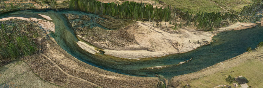
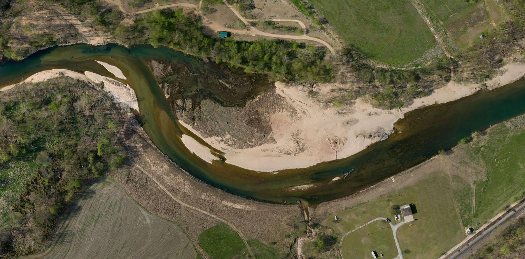
The project extends along the outer bank of the meander bend shown in the image above.
The goal is to reduce soil erosion, improve the fish and wildlife habitat, and enhance the recreational use of the river.
For more information about the project, see The Nature Conservancy webpage: The Nature Conservancy Elk River Project.
I-Map Data Systems provided drone photogrammetry and GIS development services during the course of the project to help the project manager with planning and documentation.
Drone aerial images captured on pre-planned flight paths were compiled and processed to create digital elevation models and aerial orthophotos before and after the initial project development.
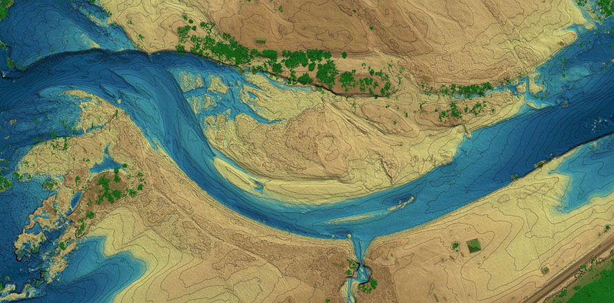
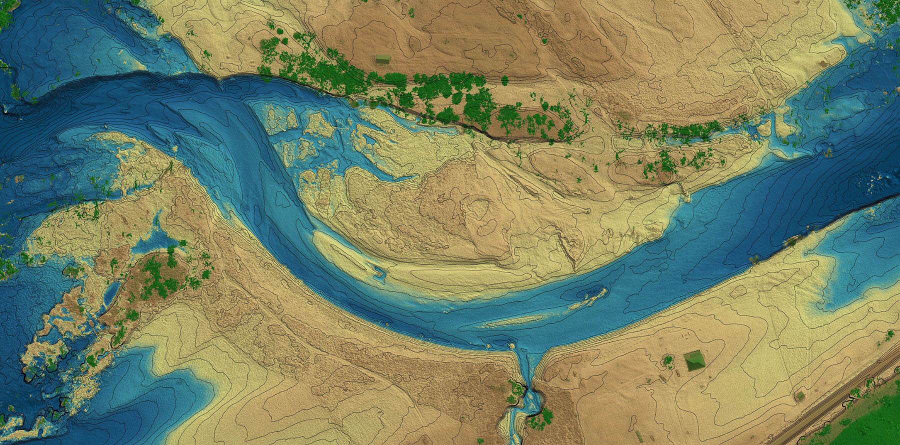
The image below shows a color rendering of the digital elevation model (DEM) produced after the streambank modification.
The DEM is produced from 3D points derived from digital processing of the drone aerial images.
The ground elevations on the DEM are typically within two tenths of a foot of surveyed elevations depending on the ground cover.
Elevations on the image are depicted by one-foot contour lines.
The button below the image opens a full screen view.
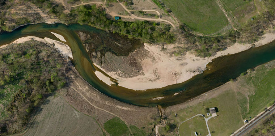
The DEM data is used to create orthophotos where the ditital image data is rectified to show all objects vertically aligned over their true ground positions. The resulting full resolution orthophotos for this project have a pixel resolution of 3 centimeters with each pixel having a positional accuracy within 6 centimeters of the true ground position. A reduced version of the orthophoto created after the initial stabilization work is shown below. It shows the stream captured by drone photography in April 2019 after the streambank modification.
3D Interactive Models
The drone imagery and 3D elevation data can be combined to form 3D image models.
The models may be viewed with 3D rendering software or browser interfaces that provide 3D display on the Internet.
A 3D interactive model based on the May 2016 imagery acquired prior to the stabilization work may be viewed below.
In this model the orthophoto is combined with DEM data that includes the vegetation, structures and objects to form a digital surface model.
Press the arrow button on the image to load the model.
An icon in the bottom right corner of the loaded model will open a full-screen view.
Interactive Viewing Controls
Use the left mouse button to change the view angle.
Use the right mouse button to shift the image position
Use the mouse wheel to zoom in and out.
Interactive Viewing Controls
Use a single finger to change the view angle.
Use two fingers to shift the image position.
Pinch or spread fingers to zoom in and out.
The model below shows 3D image points generated from the photos acquired after the initial stabilization work. The individual color points are rendered as a 3D point cloud to generate this model. The individual points may be observed by zooming in close on the model.
Interactive Viewing Controls
Use the left mouse button to change the view angle.
Use the right mouse button to shift the image position
Use the mouse wheel to zoom in and out.
Interactive Viewing Controls
Use a single finger to change the view angle.
Use two fingers to shift the image position.
Pinch or spread fingers to zoom in and out.
For information on the development of orthophotos and 3D surface models from drone aerial photography, see the I-Maps Photogrammetry Page.
Contact Mark Phillips at 417-866-6400 for more information about I-Map Data Systems.